

ISPRS Int. J. Geo-Inf. 2024, 13(5), 159; https://0-doi-org.brum.beds.ac.uk/10.3390/ijgi13050159 - 8 May 2024
Abstract
►
Show Figures
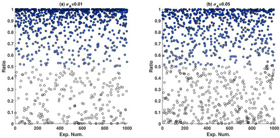
In real estate valuation using the Hedonic Price Model (HPM) estimated via Ordinary Least Squares (OLS) regression, subjectivity and measurement errors in the independent variables violate the Gauss–Markov theorem assumption of a non-random coefficient matrix, leading to biased parameter estimates and incorrect precision
[...] Read more.
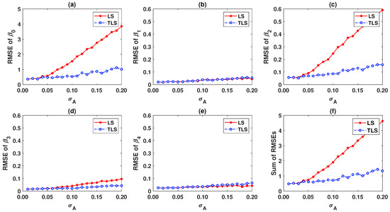
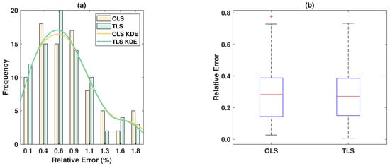
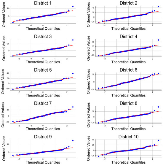
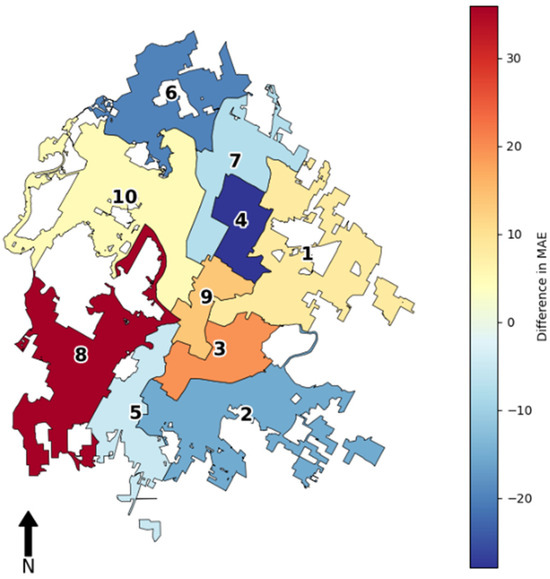
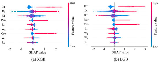
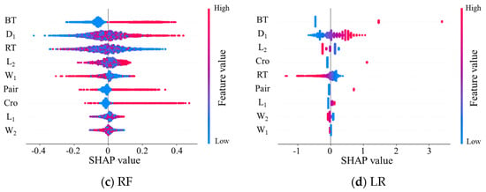
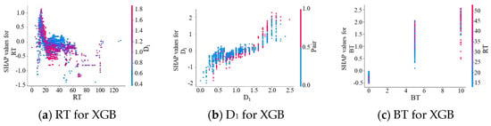
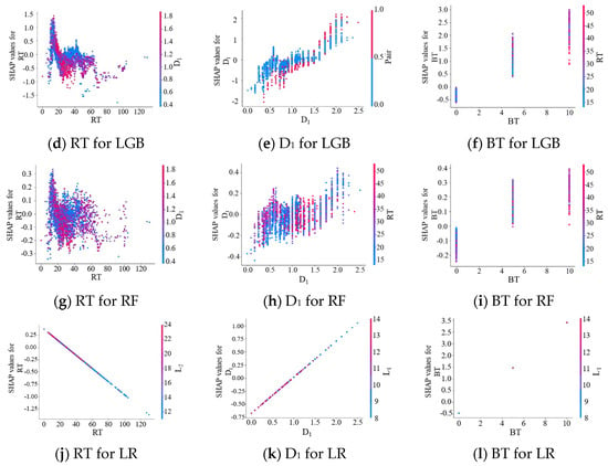
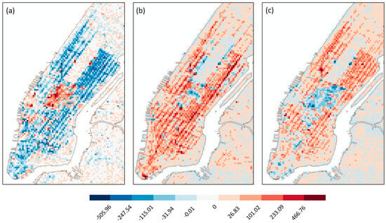
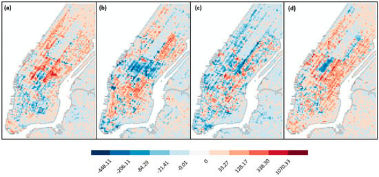
In real estate valuation using the Hedonic Price Model (HPM) estimated via Ordinary Least Squares (OLS) regression, subjectivity and measurement errors in the independent variables violate the Gauss–Markov theorem assumption of a non-random coefficient matrix, leading to biased parameter estimates and incorrect precision assessments. In this contribution, the Errors-in-Variables model equipped with Total Least Squares (TLS) estimation is proposed to address these issues. It fully considers random errors in both dependent and independent variables. An iterative algorithm is provided, and posterior accuracy estimates are provided to validate its effectiveness. Monte Carlo simulations demonstrate that TLS provides more accurate solutions than OLS, significantly improving the root mean square error by over 70%. Empirical experiments on datasets from Boston and Wuhan further confirm the superior performance of TLS, which consistently yields a higher coefficient of determination and a lower posterior variance factor, which shows its more substantial explanatory power for the data. Moreover, TLS shows comparable or slightly superior performance in terms of prediction accuracy. These results make it a compelling and practical method to enhance the HPM.
Full article

Figure 1


